Core capabilities
From AOI to export-ready datasets
LithoX gives geologists and data teams a repeatable path from area selection to trusted, source-tracked exploration data.
1
Select AOI
Start with the area you care about
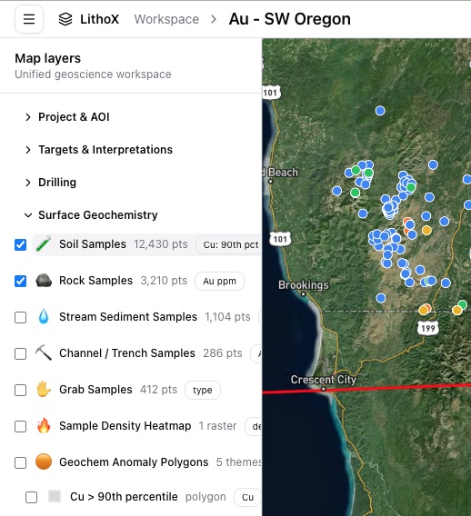
Draw a property, claim block, or district. LithoX automatically pulls relevant public geology, geochemistry, geophysics, mineral occurrences, claims, access, and terrain data from trusted sources.
LithoX connects to authoritative geological surveys, mineral occurrence databases, geochemistry repositories, geophysics catalogs, land-status datasets, and terrain sources - then clips, standardizes, and tracks provenance for the datasets relevant to your AOI.
2
Connect private data
Add your internal project data
Add drillholes, assays, geochemistry, GIS layers, contractor files, reports, or data-room packages from wherever they live.
Drillholes Assays GIS layers Contractor files Reports Data rooms
3
Normalize with AI assistance
Standardize the messy parts
LithoX detects schemas, CRS, units, element names, drillhole tables, sample types, and metadata, then converts records into consistent geoscience structures.
Collars Surveys Assays Lithology Surface samples Geochemistry Structures Mineral occurrences Target polygons
4
Review every decision
Keep geologists in control
Geologists can approve, edit, or override AI-suggested mappings, unit conversions, CRS assumptions, sample classifications, metadata extraction, and duplicate matches.
Every decision is saved to the audit trail.
Mappings Unit conversions CRS assumptions Sample classifications Metadata Duplicate matches
5
Validate before interpretation
Catch issues before interpretation
Flag missing IDs, interval errors, bad coordinates, unit ambiguity, duplicate records, suspicious nulls, unsupported land claims, and public/private data conflicts.
Every warning links back to the original source.
Missing IDs Interval errors Bad coordinates Unit ambiguity Duplicate records Suspicious nulls Unsupported land claims Data conflicts
6
Optional targeting workflow
Use clean data for targeting, or export immediately
Once your workspace is normalized and validated, you can export it directly or send it into LithoX Targeting Workflows to build transparent, geologist-controlled target rankings.
This keeps the Exploration Data Workspace focused while making targeting available when your team is ready.
Presets Visual controls Plain English criteria Weights Thresholds Buffers Evidence layers
7
Send downstream
Package clean, source-tracked data
Package clean, source-tracked data for Leapfrog, ArcGIS, QGIS, Oasis montaj, ioGAS, GeoPackage, GeoJSON, Shapefile, and CSV.
Leapfrog ArcGIS QGIS Oasis montaj ioGAS GeoPackage GeoJSON Shapefile CSV